
How Saraswati- india most sacred river disappeared
This is my third article on river saraswati. In my previous two articles, I discussed about the sacredness of river saraswati and its mention in the mankind oldest book-Rigveda. I also detailed out the government initiative steps and efforts to bring back the lost sacred river. Please go through the below link if you haven’t read these articles.
India most sacred river saraswati found
Fall and Rise of river saraswati-India most sacred river
In this article, I will detail out the scientific research and evidences related to the disappearance of river saraswati.
Introduction
In Vedic period, Indus and Saraswati was the two major river of northwestern India. Both these river has network of tributaries, some of which got diverted from its initial course to join other rivers while few of them became non-existent today.
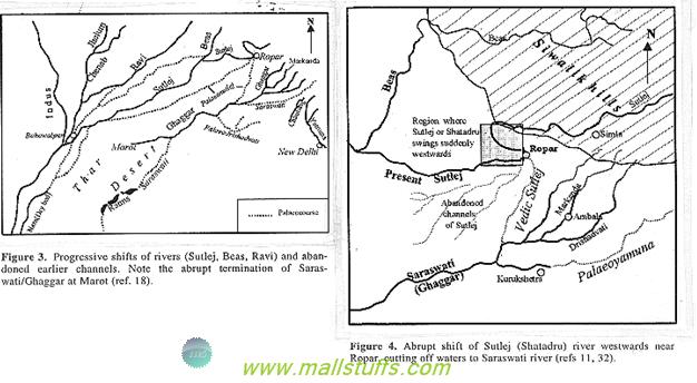
North to the Himalayas, on tracing the aravali range, Indologists found the rise in the ground level on the line of aravalis. This rise in ground level may have caused the river Yamuna, a major tributary of river Saraswati, to move eastwards from Paontasahib to join the river Ganga at Allahabad. River Sutlej, another major tributary of river saraswati, joined saraswati near jakhal and then in hanumangarh and anupgarh in Haryana. Later, it changed its course westwards near ropar to join the river Beas, (Vedic Vipasa), thus delinking from its earlier channel into the sea. Loss of two of its perennial tributaries along with the depletion of third major tributary ‘drishadvati’ caused the river Sarasvati to dry up around 3000 BC which probably led to the desertification of Rajasthan. Hydro-logical evidence of underground waters beneath the Saraswati River suggests that sand movements and ground faults led to the seepage of the remaining waters of river Saraswati to flow through underground channels thus leaving behind only a dry bed.
Modern Research
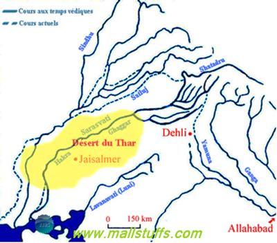
Intensive research and investigations over the last twenty years have yielded satisfactory evidences about river saraswati. Data obtained through satellite images, ground based techniques, palaeoclimatic and palaeoseismic records all have laid the path of complete rebuilding of the drainage system in north & west India. Also, scientific dating of river saraswati dry-beds plus isotopic studies of underground water below river dry beds helped in re-engineering the reconstruction efforts. Images of former river courses from NASA and LANDSAT were very helpful in digging up of underground water in saraswati plains beneath the Thar Desert from Rajasthan to the Rann of Kutch in Gujarat. In spite of massive archaelogical and geological evidences, combinative chain of natural disasters occurred during the quaternary period has postulated different reasons and interpretations about the river former courses.
Saraswati disappeared due to tectonic movement
Tectonic movement of the Indian plate in Siwalik Hills (Sirmur region) with Eurasian plate caused major geological shifts in the Himalayan regions thus diverting the course of Major River flowing from the Himalayas. Geologic studies indicate massive tectonic movements during the beginning of Pleistocene in the entire Siwalik region, extending from Potwar in present Pakistan to state of Assam in present India, thus causing massive avalanche and landslides. These tectonic disturbances is also said to be the reason behind the upliftment of the Himalayas, thereby creating many bigger peaks and mountains than anywhere else in the world. More than 70% of major peaks (at least 10 peaks with height of 7 km or above) are found in Himalayas alone.
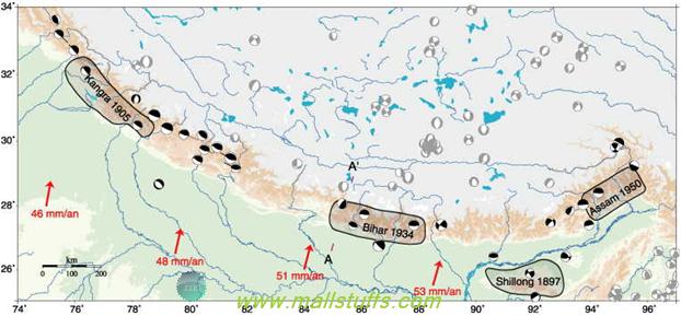
Tectonic movements in the Himalayan region
Due to high elevation of the mountains, winds were blocked which resulted in change of winds patterns thereby causing change in climatic conditions. Earliest of moderate terrains became rugged and hilly affecting the channels of rivers. This was the time (9000 BC) when Saraswati became a major river and flowed in its full ambience and so, was called as ambitame(best of all mothers) by Vedic sages. However the later of tectonic movements caused the opposite and led to its decline. Later of tectonic movements changed the glacier connection of major rivers due to the cut-off from the earlier melting glaciers. River Yamuna joined river ganga to create the present Ganga - Yamuna plain while river Sutlej joined river Indus. Due to inclusion of waters from river Sutlej, river Indus, initially a smaller one, became a bigger river post these tectonic movements.
Incidentally, the Shrimad Bhagavatam talks about such tectonic movements and holds Balrama, the brother of Shri Krishna, responsible for the change in course of river Yamuna.
According to this story, once lord balarama summoned Yamuna devi so he could bath in her waters but yamuna devi did not respond. Out of anger, Lord Balarama who always carries a plough began to drag Yamuna in a hundred streams. Seeing balarama intense anger, Yamuna Devi personally appeared and begged for mercy.
Yamuna devi begging for mercy
She gave him the permission to use her water for drinking and bathing. She later sung glory, offered prayers and paid obeisance to balarama. Pleased by her devotion, lord happily bathed in the river of water Yamuna.
As a result, bereft of major tributaries, saraswati became non-perennial and dependent on monsoon rains. Beds of River Saraswati got converted to disconnected lakes and pools some of which can be seen at Didwana, Lunkaransar and Sambhar, Pachpadra, Jaisalmer etc. Some of these lakes have become highly saline due to desertification and aridity.
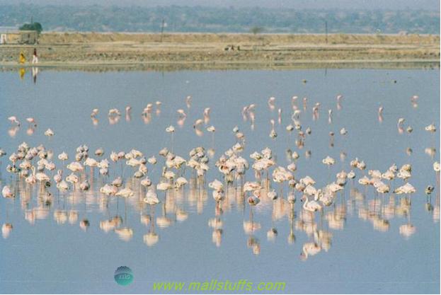
Sambhar Lake of Rajasthan
With the disappearance and decline of river Saraswati, the ancient civilizations which prospered on its banks collapsed and migrated to other parts of the country.
Many civilizations were destroyed by natural phenomenons
While tectonic movements played a major role in disappearance of river Saraswati, this was not the only reason for its downfall. Most discussed another reason for its disappearance was the Holocene, a period during which major climatic changes were noted across the whole world. Climatic changes on earth are induced by the titling of earth axis and variation in earth’s orbit. Scientifically, they are known as albedo and Milankovitch forces. This phenomenon at its peak is said to have occurred around 7000 BC.

According to recent geological research, initially there were no major deserts in the world and the onset of arid climate occurred in two pulses - Once at 4500-3400 and another one at 1900-1600 BC, both of which brought the major change in the topography of the world. This phenomenon not only led to the desertification of western Rajasthan but also the desertification in other countries like the Africa continent (Sahara and Nubia deserts). Around the same time, a global drought has been proved to have occurred which affected all the major civilizations from India to Europe. Sumerian civilization of Mesopotamia (Present Iraq) and Egyptians civilization are said to be collapsed due to this change in climate. This desertification also affected the pattern of monsoon rainfall in India. Rajasthan received very less to scanty rainfall which destroyed the vegetation, moisture, atmospheric circulation and precipitation, all ultimately resulting in the arid climate in western Rajasthan. This consequently led to the disappearance of the river saraswati.
Saraswati disappeared gradually
Recent study of radiocarbon estimates from the Lukansar Lake suggests the gradual desertification of Rajasthan and the complete aridity of Rajasthan is predicted to have occurred around 1900 BC. Before the complete desertification, some perennial lakes with water of river saraswati are believed to have existed. These lakes dried and desiccated more than 1500 years after the collapse of Indus-saraswati civilization. This also supports the dates given by Mahabharata which states the drying up of Saraswati River after the war of kurukshetra.
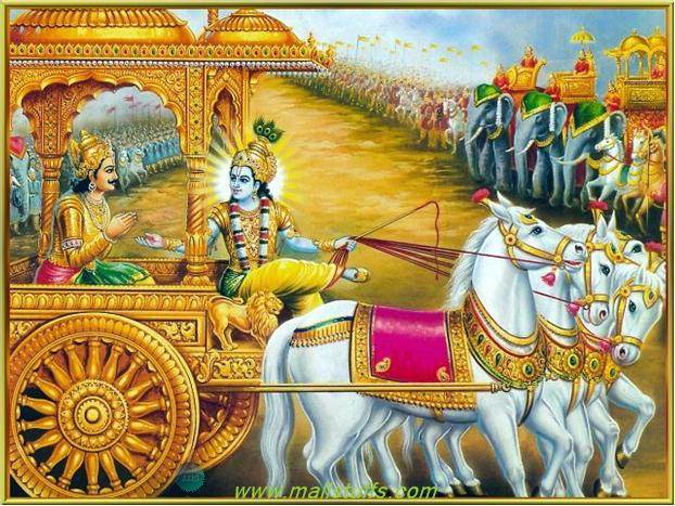
Krishna guiding arjuna before the Mahabharata war
Dr kar of ASI further confirms that "Deserts of Rajasthan and rann of kutch were prone to tectonic activities which forced the major rivers to change its direction and move westward. These climatic changes created aridity which induced the sand to choke off the river course".
Computer simulation study of natural phenomenons
Computer simulation of ancient climatic changes due to solar heating of the atmosphere suggests that variations in earth’s orbit and tilt led to the desertification f india and Africa over the span of just 300 years. However, earth topography is affected by many natural phenomenons and leading to a conclusion based on just one parameters of natural phenomenon seems to be very inappropriate. Therefore, it is very difficult to point out the exact reasons for the change in topography of river systems in ancient India. May be the future variations in earth’s tilt and orbit causes a favorable change in river system which may initiate climatic conditions for a re-greening of Rajasthan?
Isotopic studies of saraswati water
Later-day meteorological research about thermouminescenct (TL), oxygen isotopic studies, dating of river-borne and wind-borne sands in the Thar desert, radiocarbon dating of dry river beds deposits plus archaeological evidences have all confirmed that these region enjoyed heavy rainfall, wetter climate and recurring floods during early to middle Pleistocene period and desertification of this regions commenced in mid-Holocene (5100-2900 BC) only.

Desertification caused by Holocene
Geological survey of India carried out their geological survey on dry beds of river saraswati in Bikaner, Jaisalmer and Ganganagar districts of western Rajasthan and found several zones of less saline and fresh water comparable to other palaeochannels of the State. Isotope composition of underground water in ghaggar river of Jaisalmer district, indicate the water to be very old on the order of several thousand years old. Isotope composition d18O (ratio of 18O to 16O) does not depict any signs of glacial origin. In case of rainy water, The Composition of oxygen in isotope is affected by altitude. Change in temperature changes the composition of oxygen in isotoe. At lower altitudes, temperature is high and so, the lighter isotope 16O will preferentially deplete and hence, rainfall falling on the Siwaliks range (Located at lower altitudes) has a higher d18O value compared with snow/rainfall falling in the himalayan glaciers where the temperature is extremely low. Composition of groundwater in the paleo-channels of Rajasthan has higher d18O value compared with waters of Himalayan glaciers and hence, it indicates the himdlayan glaciers not contributing to the ancient river. This also validates the hypothesis that the Ghaggar River never had any glacial connections and drained in the Sivalik Himalayan range only.
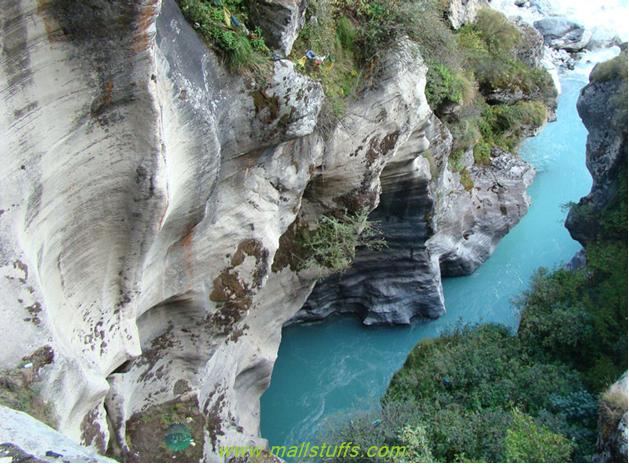
Saraswati River in Sivalik Himalayan range
Research on satellite images of river saraswati
Detailed evaluation of data deduced from remote sensing satellites, isotopic studies etc have sorted out the earlier unsolved aspects and speculative inferences of Saraswati River. Yash Pal successfully mapped the palaeochannel of Saraswati River through Haryana, Punjab and Rajasthan. If we look at the course of this river in the satellite images, then we will find lush cover of forest and vegetation along the course of the river. Enhanced digitalized studies of data obtained from satellite IRS-1C (launched in 1995), combined with images obtained from NASA, RADAR shows the palaeochannels and subsurface features below the sands of Thar Desert. These channels extend up to Marot and Fort Abbas in Pakistan and in line with the current hakra- Ghaggar River. Also, another research suggests no palaeochannel link between Saraswati and Indus River thus confirming the two as independent rivers. Also, the three palaeochannels, south of Ambala in haryana, joining the ancient bed of Ghaggar, are concluded to be tributaries of Saraswati/ Ghaggar. Incidentally, the location of these three river matches with the description of the Vedic texts where they are said to be the tributaries of river saraswati.
Conclusion
Hundreds of evidences can be found in Indian scriptures about the numerous centers of learning and education on banks of river saraswati and its tributaries. According to ancient scholarly traditions, written mode of learning was considered as lack of wit and intelligence and therefore, only the oral process of learning was used for the dissemination and preservation of the Vedic knowledge. However, seeing the degradation of intelligence and lack of interest in spiritual teachings plus more affinity towards materialistic pleasures amongst the civilized generations, Vedic sages started composing the Vedas in written form and the first Vedas(Rig veda) is said to be composed around 1o000 BC. For the spread, improvement and preservation of vedic teaching and vedic philosophy. Ascetics and scholars would meet every 12 years (Cycle of solar eclipse) at Paryag (Allahabad) after taking a dip on the confluence of three rivers before the sunset of the solar eclipse.
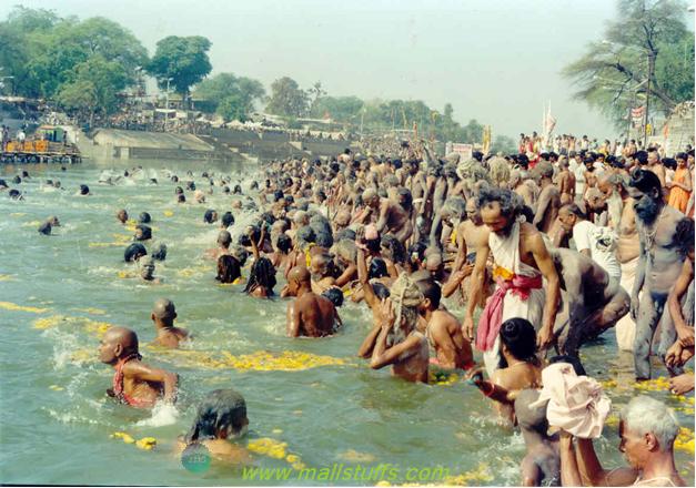
Sages and Devotees taking a bath at prayag, Allahabad
Since Allahabad was more or less situated at the geographic center of India, it was considered as the ideal location for periodic meetings by ascetics and scholars. While travelling to Allahabad from different parts of the country, they would disseminate and share their scriptural knowledge to the villagers.
Saraswati is said to be disappeared after the Mahabharata war, due to earthquake, climatic reason, and tectonic movement between the layers of the earth, saraswati was left with only few small tributaries, finally taking form of a dry valley in deserts of Rajasthan. This civilization was so much dependant on saraswati river that post its disappearance, population started migrating to south, east, north to settled on the banks of river Ganges, Godavari, Krishna and kaveri.
Different migratory routes post the collapse of Indus-saraswati civilization
In these new locations, they pre-dominantly became an agricultural community rather than industrial economy but they followed their culture of venerating the lost river as their best mother, goddess of wisdom, knowledge and learning. This dependence justifies the rig vedic title ‘ambitame’ honoured to swraswati (Ambitame means best of the mothers). Vedic sages rightly praised saraswati as goddess of knowledge and fertility.

Goddess saraswati
Before Ending, a sacred hymn dedicated to goddess saraswati
Sanskrit verse
Yaa Kundendu tushaara haaradhavalaa, Yaa shubhravastraavritha|
Yaa veenavara dandamanditakara, Yaa shwetha padmaasana||
Yaa brahmaachyutha shankara prabhritibhir Devaisadaa Vanditha|
Saa Maam Paatu Saraswatee Bhagavatee Nihshesha jaadyaapahaa||
English Translation:
"May Goddess Saraswati,
who is fair like the jasmine-colored moon,
and whose pure white garland is like frosty dew drops;
who is adorned in radiant white attire,
on whose beautiful arm rests the veena,
and whose throne is a white lotus;
who is surrounded and respected by the Gods, protect me.
May you fully remove my lethargy, sluggishness, and ignorance?"
Note: Images used on this website
are either a production of Bhaktivedanta Book Trust(https://www.krishna.com), Iskcon
Foundation or were found in google search under "Free to use and share". If any
of the images presented here violates copyright issues or infringes anyone copyright
or are not under "Fair use", then please bring it to our notice. Read
Disclaimer for more.
Share this to your friends. One of your friend is
waiting for your share.
Related Articles
Scientific explanation of Hindu cosmology and reincarnation
Floating stones of Shri Ram Setu
Is god female-Yes or No
Science in Hinduism-Motion of earth around sun
Science in hinduism-Embryology in Bhagavad purana
Science in hinduism-Extraction-Contraction and creation of universe
Science in Hinduism-Gravitational force and repulsive force
Did Egyptians worshipped lord krishna
Chakravyuha-The most deadliest and brilliant military formation
Meaning and significance of Swastika-Hinduism sacred symbol
Post Comment